| 1 | Atlas44A
Le grand & nouveau miroir ou flambeau de la mer, uitgegeven door Jacob en Caspar Lootsman, 1666Le grand & nouveau miroir ou flambeau, de la mer contenant la description de toutes les costes marines occidentalles & septentrionnalles, desmonstrant en plusieurs cartes tres necessaire tous les ports, fl... |  | 
Maritiem Museum Rotterdam | |
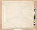
| 2 | Atlas98_34
Kaart van de monding van de Elbe door Johannes Janssonius, ca. 1630.Nobilis Fluvius Albis maxima cura, ex variis famosisq. Autoribus collectus et in lucem editus. a Ioanne Ianssonio Amstelodami. | |
Maritiem Museum Rotterdam | |
| 3 | Atlas98_37
Kaart van het hertogdom Holstein door Henricus Hondius, ca. 1630.Ducatus Holsatiae Nova Tabula | |
Maritiem Museum Rotterdam | |
| 4 | AV953
Riding High | |
Maritiem Museum Rotterdam | |
| 5 | B17482t-P39
Nova Totius Orbis Terrarum Descriptio | |
Maritiem Museum Rotterdam | |
| 6 | DB9415
Smit International Tug Service | |
Maritiem Museum Rotterdam | |
| 7 | F52636
Het laden of lossen van de sleepboot 'Noordzee' van Aannemersbedrijf R. Boltje en Zonen voor Santos aan boord van het s.s. 'Zaanland' | |
Maritiem Museum Rotterdam | |
| 8 | F83740
stoomsleepboot 'Noordzee' (I) voor anker | |
Maritiem Museum Rotterdam | |
| 9 | F83741
stoomsleepboot 'Noordzee' (I) voor anker | |
Maritiem Museum Rotterdam | |
| 10 | F83742
stoomsleepboot 'Noordzee' (I) voor anker | |
Maritiem Museum Rotterdam | |
| 11 | F86742
m.t. 'Noordzee' varend op volle zee | |
Maritiem Museum Rotterdam | |
| 12 | FS5422
prentbriefkaarten en foto's van baggervaartuigen van diverse baggerbedrijven: Boskalis Westminster, H.A.M.,Zanen Verstoep etc. | |
Maritiem Museum Rotterdam | |
| 13 | K1291
Hydrographische kaart van het Brouwershavensche Zeegat, Roompot en Oosterschelde. | |
Maritiem Museum Rotterdam | |
| 14 | K1292
Kaart van de zeegaten van Goeree en de MaasHydrographische kaart der Zee-gaten van Goeree en de Maas trigonometrisch opgenomen en in plan gebragt in 1823 door J.C. Rijk, destijds kapitein luitenant ter zee herzien op last van het Departement van Marine in 1839 en 1853 door A.R. van Rhijn kapitein lu... | |
Maritiem Museum Rotterdam | |
| 15 | K1314
Steel's New and Accurate Chart of the Southern part of the North Sea, comprehending the eastern coasts of England from Dungeness to Lynn Deeps, and the opposite coasts of France and Holland from Cape Grisnez to the Texel. | |
Maritiem Museum Rotterdam | |
| 16 | K1315
Laurie's Chart of the Kattegat. the Sound and the Belts compiled from government surveys. Revised edition 1899 | |
Maritiem Museum Rotterdam | |
| 17 | K1316
The North Sea compiled from the most recent surveys. London published by Ja.s Imray and Son ... 1882 | |
Maritiem Museum Rotterdam | |
| 18 | K1317
The North Sea. | |
Maritiem Museum Rotterdam | |
| 19 | K1319
Estuary of the Thames compiled from recent government surveys. | |
Maritiem Museum Rotterdam | |
| 20 | K1320
English Channel | |
Maritiem Museum Rotterdam | |