| 21 | BWAE352-P31
Kaart van de Atlantische Oceaan en delen van Afrika, Amerika en EuropaNuevo Mundo |  | 
Maritiem Museum Rotterdam | |
| 22 | BWAE355-P10
Kaart van de Atlantische Oceaan en delen van Afrika, Amerika en EuropaNuevo Mundo | |
Maritiem Museum Rotterdam | |
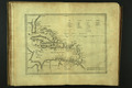
| 23 | BWAE859a-P04
Description del destricto del avdiencia dela espanola | |
Maritiem Museum Rotterdam | |
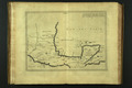
| 24 | BWAE859a-P05
Descripcion del destricto del avdiencia de nveva espana | |
Maritiem Museum Rotterdam | |
| 25 | K1327
Approaches to Brest | |
Maritiem Museum Rotterdam | |
| 26 | K1335
Coasts of Great-Britain, Ireland, France, Spain, Portugal, & c., showing the whole navigation from the Feroe and Orkney Isles to Gibraltar, Barcelona, Algiers &c. | |
Maritiem Museum Rotterdam | |
| 27 | K1338
West coast of Scotland with the Hebrides or Western Isles. | |
Maritiem Museum Rotterdam | |
| 28 | K1345
West coast of Europe included between the British Islands and the Mediterranean. - 74. | |
Maritiem Museum Rotterdam | |
| 29 | K1347
Coast of Spain and Portugal included between Cape Peñas and Gibraltar - 140c, | |
Maritiem Museum Rotterdam | |
| 30 | K1348
Coast of Spain and Portugal included between cape Peñas and Gibraltar - 77. | |
Maritiem Museum Rotterdam | |
| 31 | K1350
Chart of the coasts of Spain, Portugal and Barbary, from St. Sebastian to Cape Blanco North; with part of the Mediterranean Sea; including particular plans of the principal harbours, &c. | |
Maritiem Museum Rotterdam | |
| 32 | K1351
Laurie's new chart of the coasts of Spain, Portugal and Barbary, from St. Sebastian to Cape Blanco North; with part of the Mediterranean Sea; including particular plans of the principal harbours, &c. | |
Maritiem Museum Rotterdam | |
| 33 | K1352
Cape Verde Islands - Chart no. 127. | |
Maritiem Museum Rotterdam | |
| 34 | K1353
A chart of the Cape Verde Islands, drawn from the latest authoroties by J.W. Norie, hydrographer | |
Maritiem Museum Rotterdam | |
| 35 | K1356
A new and accurate chart (from captain Holland's surveys) of the North American coast for the navigation between Cape Cod in Massachusets, and the river Missisipi. | |
Maritiem Museum Rotterdam | |
| 36 | K1357
North Atlantic - Chart no. 120 | |
Maritiem Museum Rotterdam | |
| 37 | K1358
North Atlantic - Chart no. 121 | |
Maritiem Museum Rotterdam | |
| 38 | K1359
South Atlantic Ocean | |
Maritiem Museum Rotterdam | |
| 39 | K1405
South America - North-east coast - sheet III - Cabo do Norte to São Louis - no. 1803. | |
Maritiem Museum Rotterdam | |
| 40 | K1406
South America - North-east coast - sheet II - Suriname to Cabo do Norte - no. 1802. | |
Maritiem Museum Rotterdam | |