| 41 |
Zierikzees vlagvertoon : beschouwingen over het paneel De rede van Zieirkzee (anoniem, eerste helft zestiende eeuw) |  | 
Maritiem Museum Rotterdam | |
| 42 |
Beschilderd dundoek uit Middelharnis | |
Maritiem Museum Rotterdam | |
| 43 |
The language of the sea : flags and identities in early modern Dutch marine painting | |
Maritiem Museum Rotterdam | |
| 44 | 11152
Wet van den 28sten mei 1869, betrekkelijk de afgifte van zeebrieven en vergunningen tot het voeren der Nederlandsche vlag | |
Maritiem Museum Rotterdam | |
| 45 | 11746
Das kleine ABC der Schiffahrt | |
Maritiem Museum Rotterdam | |
| 46 | 12067
Het Indische boek der zee | |
Maritiem Museum Rotterdam | |
| 47 | 13883
Philips' centenary mercantile marine atlas : a series of 44 plates containing over 220 charts and plans showing passenger and freight routes throughout the world, giving distances in nautical miles, with tables of 12,000 distances between ports and a diagrammatic chart for calculating speed, time an... | |
Maritiem Museum Rotterdam | |
| 48 | 13950
Ships and the sea : a cruising companion | |
Maritiem Museum Rotterdam | |
| 49 | 14324
Vlaggen en wimpels van de Nederlandsche watersportvereenigingen | |
Maritiem Museum Rotterdam | |
| 50 | 14698
Sea flags : their general use | |
Maritiem Museum Rotterdam | |
| 51 | 19988
All about ships and shipping : a handbook of popular nautical information | |
Maritiem Museum Rotterdam | |
| 52 | 200007703
Toelichtende Figuurlijke Voorstelling van Eenige Seinen voorgeschreven in het bij Koninklijk besluit van 28 Augustus 1926 (Staatsbald No. 317) vastgestelde Binnenaanvaringsreglement | |
Maritiem Museum Rotterdam | |
| 53 | 26788
The 1931 international code of signals | |
Maritiem Museum Rotterdam | |
| 54 | 27711
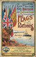
Flags of Britain and her colonies, also the standards and flags of all nations | |
Maritiem Museum Rotterdam | |
| 55 | 27981
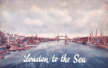
London to the sea : nautical and general information with special reference to the port of London | |
Maritiem Museum Rotterdam | |
| 56 | 28413
Philips' mercantile marine atlas : a series of 35 plates containing over 200 charts & plans, with tables of 10,000 distances between ports, national & commercial flags, lists of British & United States consulates, and complete index of 20,000 ports, &c. : specially designed for merchant shippers, ex... | |
Maritiem Museum Rotterdam | |
| 57 | 28654
Philips' mercantile marine atlas : a series of 37 plates containing over 200 charts & plans, with tables of 10,000 distances between ports, national & commercial flags, cable & wireless telegraphy charts with list of wireless stations, list of British & United States consulates, and complete index o... | |
Maritiem Museum Rotterdam | |
| 58 | 29539
Jottings for the young sailor | |
Maritiem Museum Rotterdam | |
| 59 | 30616
Plan de plusieurs bâtimens de mer. avec leurs proportions, et les pavillons, et les enseignes, que chaque nation porte à la mer | |
Maritiem Museum Rotterdam | |
| 60 | 37569
Die Marine : unter Berücksichtigung der Fortschritte der gegenwart und unter Hinzufügung der in Oesterreich gebräuchlichen italienischen Termonologie | |
Maritiem Museum Rotterdam | |